
When I use my iPhone 7 in airplane mode, apps usually complain that GPS location isn't available. That's because typically the GPS receiver is integrated into the cellular radio - GPS being a requirement in the U.S. so that emergency services can locate you when you dial 911 - and when GPS isn't available (for example, when you're indoors), your phone may use cell tower triangulation and WiFi router identification to determine your location. In airplane mode, I'd expect all of these radios to be turned off.
My iPhone was in airplane mode, but I had just the WiFi radio enabled to use the in-flight WiFi - mostly, I confess, as an experiment, having worked on business aviation products that provide that service. Apparently this was enough to enable the GPS receiver, but, I assume, keep the RF section of the cellular radio turned off. This tells me something interesting about how iOS manages its RF resources.
(Querying the Salmon of Knowledge, as I've come to call internet searches following my recent travels in Ireland, one article says that the iPhone has a GPS receiver separate from the cellular radio. Another says that in more recent versions of iOS, GPS is never disabled in airplane mode.)Flickr typically displays the geotag, if available in the metadata in the photograph, as a tiny map with a place name underneath it that is a URL that does a search for photographs with a nearby geotag. But in this case, it was just a square of blue labelled with "A mysterious place with no name".

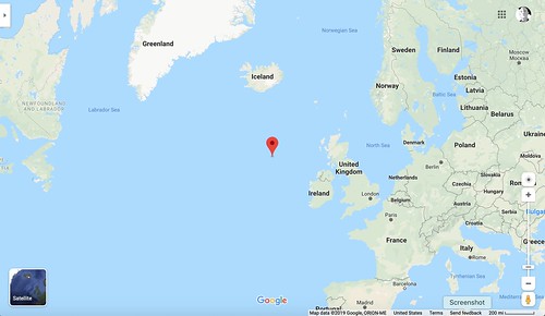
When I looked at the URL, it had the latitude and longitude encoded as parameters.
https://www.flickr.com/search/?lat=56.798622&lon=-16.282175&radius=0.25&has_geo=1&view_all=1
I pasted 56.798622, -16.282175 into Google Maps, and got a result properly way out in the Atlantic.
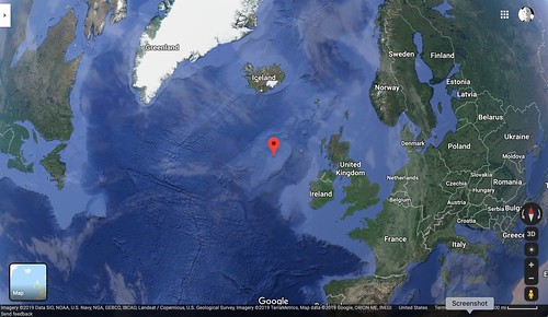
Dropping into satellite view, I got an orbital image of where the 757 was when I took the photograph.
Readers of my blog (all two of you) may recall that I've done some work integrating my own GPS software with Google Earth and remotely tracked my travel with a moving map display as I drove my automobile around, with a Raspberry Pi running my software and a GPS receiver and an LTE modem sitting on the dashboard [Better Never Than Late]. It hadn't really occurred to me until now that you could do something similar with an aircraft and create your own moving map display if you had internet access to Google while airborne.
Of course this is exactly what the aircraft does with its own moving map display, except that the map is onboard in some box in the avionics bay. Although I didn't work on that particular feature, at least two of the business aircraft products for which I was one of the developers did exactly that, using the GPS coordinates provided by the aircraft navigation system over an ARINC 429 serial bus.

