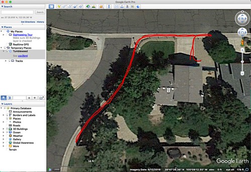
Here is the resulting image, showing my path just around my home.
Typically, conventional GPS is accurate to only about fifteen feet or about five meters. Really, it boils down to it being accurate to about fifteen nanoseconds - due to variation like jitter in the scheduling of signals to be transmitted from the satellites - because everything is computed from the time differences in the signals. This is why your car navigation system sometimes take a moment to realize you've taken an exit ramp off the highway. But DGNSS can have a much higher degree of accuracy; in my case: down to an inch (2.5 centimeters) or so. However, that doesn't mean that Google Earth is that accurate in its mapping on satellite imagery. Testing this project has been my major challenge. Like I did with my cesium atomic clock, I've built a device that may be more accurate than anything I have with which to test it.
Typically, conventional GPS is accurate to only about fifteen feet or about five meters. Really, it boils down to it being accurate to about fifteen nanoseconds - due to variation like jitter in the scheduling of signals to be transmitted from the satellites - because everything is computed from the time differences in the signals. This is why your car navigation system sometimes take a moment to realize you've taken an exit ramp off the highway. But DGNSS can have a much higher degree of accuracy; in my case: down to an inch (2.5 centimeters) or so. However, that doesn't mean that Google Earth is that accurate in its mapping on satellite imagery. Testing this project has been my major challenge. Like I did with my cesium atomic clock, I've built a device that may be more accurate than anything I have with which to test it.
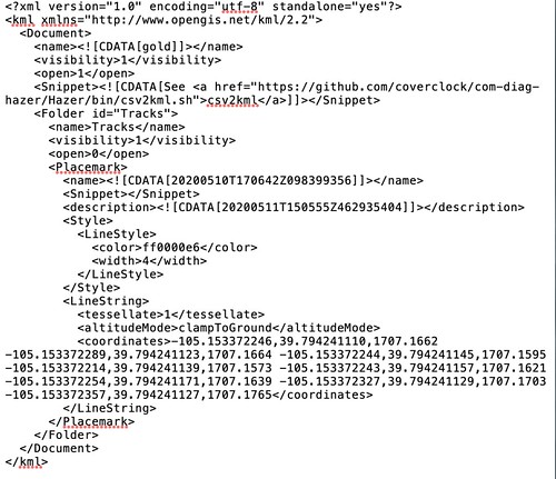
The data format I used to feed my track to GEP is called the Keyhole Markup Language (KML), a snippet of which is shown above. KML is a pretty simple (and well documented) XML-based language, and it wasn't difficult to write a little script to reformat the CSV output from my software into KML. What's most interesting to me about KML is the use of the word "Keyhole". Keyhole was the code name for the early U.S. reconnaissance satellites - probably not a coincidence.
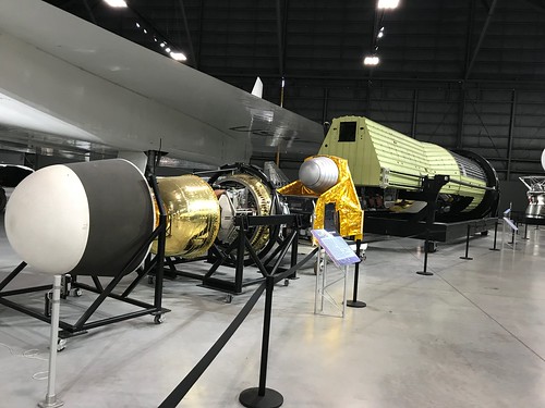
This is a photograph I took in 2013, at the National Museum of the United States Air Force in Dayton Ohio, of a KH-9 (note the code letters) "Hexagon" reconnaissance satellite. It's the size of a train boxcar. Rumor has it that the main stakeholder that originally pushed for the NASA Space Shuttle was the U.S. intelligence community, who required a launch vehicle capable of putting ginormous satellites like this into orbit.
Here is another photograph of the KH-9 a little closer up. You can barely see the gimbaled camera assembly at the bottom right.
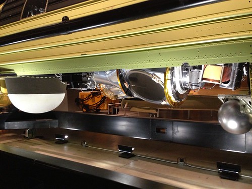
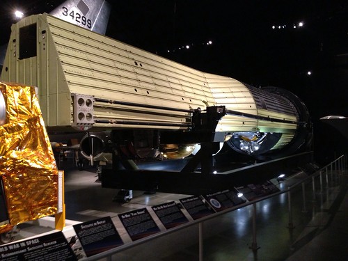
Here is a close-up of the camera assembly. The white dome to the left (and visible separately in a photograph above) is one of the four reentry vehicles used to recover exposed film from the KH-9. The film canisters were snatched from the air by aircraft as the canisters parachuted down over the Pacific. Given only four opportunities to recover imagery taken by the film camera, and the cost of putting such a massive payload into orbit, you can bet that the decision on how to use those opportunities were made at a high pay grade.
The KH-9 was a precursor of the far smaller commercial Earth imagery satellites - which now, of course, take digital photographs that are downlinked to ground stations - that we take for granted every day when we use tools like Google Earth and Google Maps in the Satellite View.


No comments:
Post a Comment